
Cuts FAQ
What types of cuts are available for my campaign?
Tactic
See How to Complete Tactic Mapping
Target Audience
See Target Audiences
Standard
Age
Age (Broad)
Census Division*
Census Region*
Gender
Median Income*
Metro Area*
Overall
Respondent Operating System
State*
Urbanicity*
*US only
Question
Time-Based
Frequency Levels
Frequency Ranges
Rounded days since last exposure
Survey Completion Month
Survey Completion Quarter
Standard Crosses
Age X Gender
Age X Gender X Survey Completion Month
Age X Survey Completion Month
Census Division X Survey Completion Month*
Census Region X Survey Completion Month*
Gender X Survey Completion Month
Target Audience X Survey Completion Month**
Target Audience X Survey Completion Quarter**
*US only
**generated ~1 week after campaign launch
Custom
Most often, custom cuts are used to enable cross cuts that can't be created via tactic mapping. Request Cross Cuts
Which states are included in each Census Division and Census Region?
Midwest: Illinois (IL), Indiana (IN), Iowa (IA), Kansas (KS), Michigan (MI), Minnesota (MN), Missouri (MO), Nebraska (NE), North Dakota (ND), Ohio (OH), South Dakota (SD), Wisconsin (WI)
East North Central: Illinois, Indiana, Michigan, Ohio, and Wisconsin
West North Central: Iowa, Kansas, Minnesota, Missouri, Nebraska, North Dakota, and South Dakota
Northeast: Connecticut (CT), Maine (ME), Massachusetts (MA), New Hampshire (NH), New Jersey (NJ), New York (NY), Pennsylvania (PA), Rhode Island (RI), Vermont (VT)
Middle Atlantic: New Jersey, New York, and Pennsylvania
New England: Connecticut, Maine, Massachusetts, New Hampshire, Rhode Island, and Vermont
South: Alabama (AL), Arkansas (AR), Delaware (DE), District of Colombia (DC), Florida (FL), Georgia (GA), Kentucky (KY), Louisiana (LA), Maryland (MD), Mississippi (MS), North Carolina (NC), Oklahoma (OK), South Carolina (SC), Tennessee (TN), Texas (TX), Virginia (VA), West Virginia (WV)
East South Central: Alabama, Kentucky, Mississippi, and Tennessee
South Atlantic: Delaware, District of Columbia, Florida, Georgia, Maryland, North Carolina, South Carolina, Virginia, and West Virginia
West South Central: Arkansas, Louisiana, Oklahoma, and Texas
West: Alaska (AK), Arizona (AZ), California (CA), Colorado (CO), Hawaii (HI), Idaho (ID), Montana (MT), Nevada (NV), New Mexico (NM), Oregon (OR), Utah (UT), Washington (WA), Wyoming (WY)
Mountain: Arizona, Colorado, Idaho, Montana, Nevada, New Mexico, Utah, and Wyoming
Pacific: Alaska, California, Hawaii, Oregon, and Washington
What are Urbanicity cuts?
Our definition of urbanicity comes from the 2010 Decennial Census data. The census defines three types of areas:
Urbanized Areas - Areas with 50,000 or more people
Urban Clusters - Areas with 2,500 to 50,000 people
Rural - All other areas
They use some agglomeration techniques to determine what constitutes an ‘area’, but essentially if you’re near a population dense area, you will likely be considered part of that area. At the zip code level, each zip code is categorized by the percent of people in living in each type of area. Our definition of urbanicity from those percentages is:
Rural - % rural > 50%
Small Town - % rural < 50% & % urbanized < 50%
Large City - % urbanized > 50%
Request cross cuts
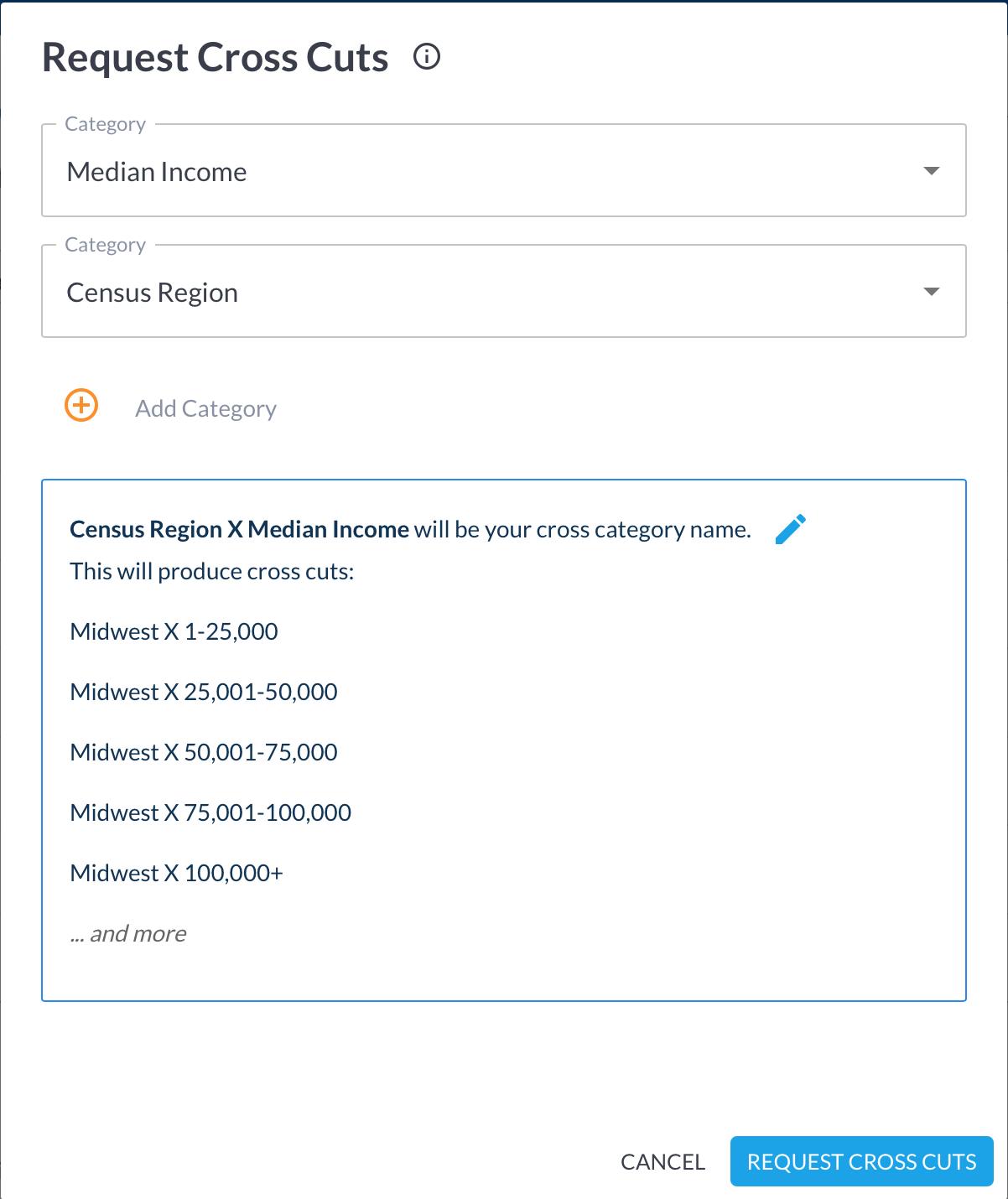
Cross categories with each other to request creation of cross cuts. A cross cut ensures that all of the conditions in the cut name are true.
Cross up to 3 categories with each other to request creation of a maximum of 500 cross cuts. You may have to change or remove selected categories in order to create fewer cuts.
New cuts will be created within 2 business days of your request.
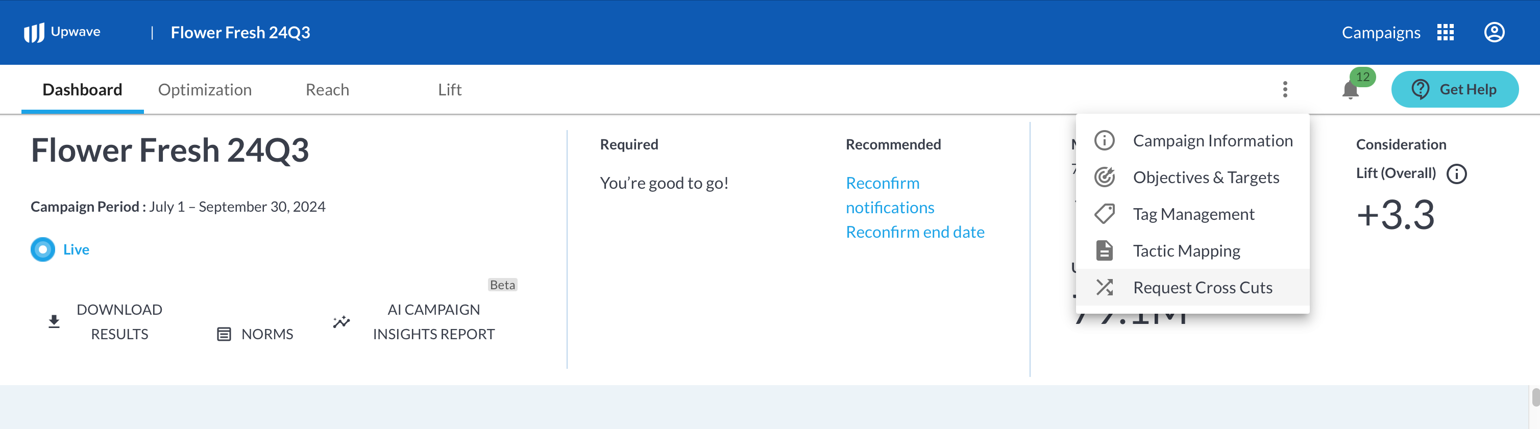
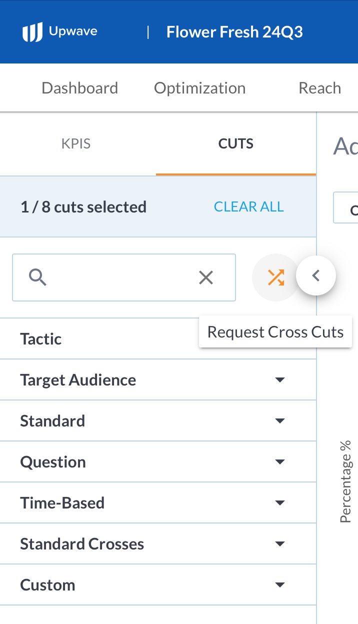
Click "Request Cross Cuts" from the campaign dashboard or cuts sidebar.
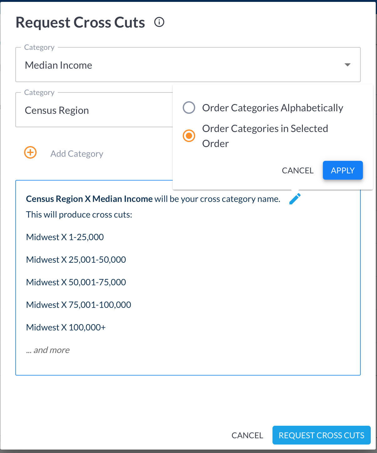
Select the categories to cross and review the preview. The resulting cross category name defaults to the source categories in alphabetical order, delimited by " X ":
To update the resulting cross category name, click the pencil icon to edit, choose either alphabetical or selection order, then click Apply.
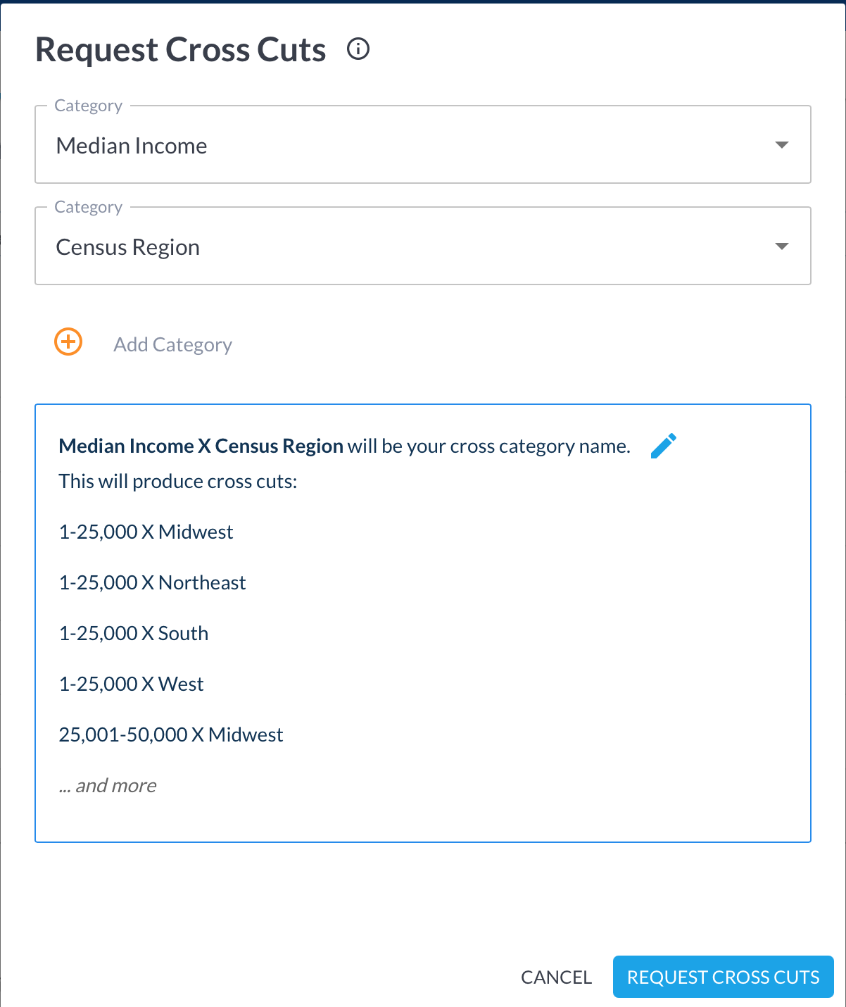
When ready, click Request Cross Cuts to submit your request.
Request other custom cuts
If you are interested in adding other custom cuts, please work with Support to see if custom cuts are feasible and/or recommended for your campaign.
Log in to the Upwave platform and click the Get Help button. To avoid delays:
Select the "Cuts and Tactic Mapping" option when prompted, which will route your request to the right person quickly.
Include the list of Custom Cuts that you would like created.
A member of our Support Team will get back to you within 48 hours.